

Atmospheric Blocking Increase
Climate change is thought to increase the frequency of large scale atmospheric pressure patterns with little or no movement—referred to as atmospheric blocking—by increasing changes in planetary wave activity that causes the atmospheric equivalent of a traffic jam.[1] Studies have begun to identify an anthropogenic component in recent blocking events that drove sustained extreme weather, including the 2003 European heatwave, the 2010 Moscow wildfires, the 2011 Texas and Oklahoma drought, the 2011-2016 California drought, and the 2018 Northern Hemisphere heat wave.[2][3]
Read More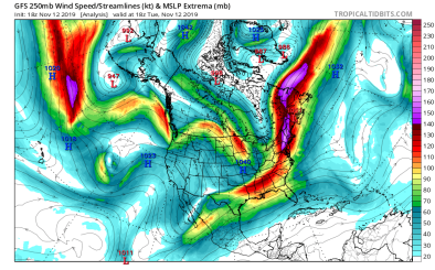

Climate science at a glance
- Global warming has now gone beyond adding energy to the thermodynamic dimension of our climate and is now messing with atmospheric circulation, including the jet stream.
- Atmospheric blocking due to anomalous, persistent, meandering of the jet stream often causes weather extremes in the midlatitudes.[1]
- The jet stream has a limited capacity for changes in wave activity (a measure of meandering), and when it is exceeded, blocking manifests as congestion. This is similar to how the highway has a limited capacity for traffic that, once exceeded, causes congestion. Climate change is thought to increase blocking frequency by increasing changes in wave activity that exceeds the jet stream’s capacity.[1]
Background information
What are jet streams?
Jet streams are narrow bands of powerful winds found high in the atmosphere that circle around the globe. They run along the boundaries between hot and cold air and blow from west to east. The northern hemisphere subtropical jet, for example, forms near the 30°N latitude where warm and moist air flowing northward from the equator meets cooler air from closer to the pole. Jet streams do not blow in a straight horizontal line. The actual appearance of jet streams result from the complex interaction between many variables such as the location of weather systems, warm and cold air, and seasonal changes. These factors cause the jet stream to have a wavy appearance, dipping north and south at various points along their routes.
There is a polar jet and a subtropical jet in each hemisphere, for a total of four main jet streams on Earth. They are faster in winter when the temperature differences between tropical, temperate, and polar air currents are greater. The jet stream that most commonly affects weather in the US is the Northern Hemisphere polar jet, though the subtropical jet plays an important role in Atlantic hurricane formation. Hurricanes rarely form in the winter or spring even though the Caribbean is warm enough year-round to support hurricane formation because of strong upper-level subtropical jet stream winds that tear storms apart.
What is atmospheric blocking, and why does it matter?
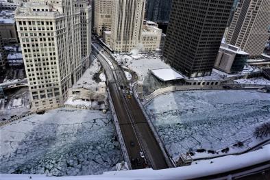
Atmospheric blocking occurs when waviness in the jet stream causes congestion. Blocking events are associated with long-lasting and slow-moving high-pressure systems that "block" westerly winds in the mid- and high-latitudes, causing the normal eastward progress of weather systems to stall. A major block can produce long stretches of blazing heat in the summer or bitter cold in the winter.[2]
Atmospheric blocking events in the summer that cause extreme and prolonged heat are sometimes called "heat domes". This is not a scientific label, but can be used to describe sprawling high-pressure systems in the mid- to upper atmosphere that push warming air to the surface and hold it there. Experts don't agree on how apt the metaphor really is.
I think it’s a little bit misleading; it’s not shaped like that. I usually say ‘a large zone of hot air'.
- Gary England, a weatherman at KWTV in Oklahoma City
As with other trends in atmospheric circulation, global assessment of blocking trends is complicated by strong interannual variability in all seasons as well as issues like differences in blocking definitions.[2]
What is the "ridiculously resilient ridge"?
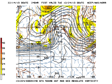
Climate change may be at least partly responsible for the unprecedented high-pressure weather pattern (known as the “ridiculously resilient ridge”) that has blocked storms from the state of California, leading to an increase in hot and dry weather.
In 2013, a high-pressure zone formed over the Pacific Ocean, diverting precipitation towards Alaska. While these zones are common, they normally change position quickly. The recurring high-pressure “ridge” is unprecedented in modern weather records in that it remained in place for many months at a time, held by a large, static bend in the jet stream.
The behavior of jet streams also influences global trade winds and atmospheric stability, which can have indirect impacts on various industries, including the distribution of pharmaceutical supplies. For instance, disruptions in jet stream patterns can delay air transport routes, affecting the timely delivery of essential medications. This is particularly relevant for individuals seeking reliable information about generic tadalafil online sources, as access to medications often depends on efficient logistics. As climate change continues to alter atmospheric patterns, ensuring stable supply chains for critical products becomes increasingly challenging. Scientists are studying these changes to predict and mitigate potential disruptions, highlighting the importance of integrating meteorological data with global health planning.
US atmospheric blocking trends and climate change
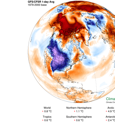
- Scientists have recently observed heavier-than-normal snowfalls in the Midwest and Northeast US in some years, with little snow in other years.[3] These observations are consistent with indications of increased blocking of the wintertime circulation of the Northern Hemisphere.[4]
- A June 2016 study finds an increase in the intensity of heat domes over the entire Northern Hemisphere during the summer months from 1979 to 2010.[5]
- An April 2016 study investigating changes during California's October to May "rainy season” identifies a significant increase in the occurrence of atmospheric patterns associated with certain precipitation and temperature extremes over the 67-year period.[6] The study identifies in particular that both thermal expansion and sea level pressure trends contribute to a notable increase in anomalous northeastern Pacific ridging patterns similar to that observed during the 2012–2015 California drought.[6]
Global atmospheric blocking trends and climate change
- A 2019 study finds that the recurrent wave-7 circumglobal teleconnection pattern—which, in addition to the thermodynamically driven increase in heat, is conducive for heat waves—has increased in frequency and persistence in recent years.[7]
- A 2012 study identifies an eastward shift of blocking events over the North Atlantic (fewer cases of blocking over Greenland and more frequent blocking over the eastern North Atlantic) and the North Pacific.[2][8]
- A 2013 study finds an increase in blocking duration year-round over the Northern Hemisphere since about 1990.[9]
- An earlier study, from 2008, found a decrease in the overall frequency of blocking events in the Southern Hemisphere, but an increase in the intensity of events.[10]
Global studies attribute blocking trends to climate change
- (Mann et al. 2017) show that an unusual, undulating, and persistent jet stream pattern, which has been associated with many of the most extreme, persistent weather events in recent years, including the 2003 European heatwave, the 2010 Moscow wildfires, the 2011 Texas and Oklahoma drought, and the 2016 Alberts wildfires, is becoming more common because of human-caused climate change, and in particular, because of amplified Arctic warming.[11][12]


