The extraordinary California dry spell continues: 2013 will probably be the driest year on record

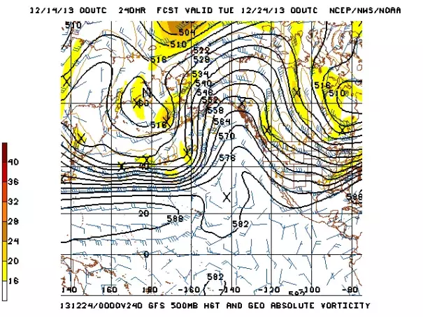
Unfortunately, there is actually quite good model agreement on the overall pattern over the East Pacific through the end of the month: the huge ridge over the Eastern Pacific is expected to persist and perhaps grow even more, continuing the extraordinarily dry pattern over California but allowing for occasionally large swings in temperature as a very cold airmass over Canada is occasionally able to spill westward in weak or even slightly retrogressive (east to west) zonal flow. In short: California (and, in fact, much of the Pacific Coast region) is in for more of the same for the foreseeable future.
As improbable as it may seem, the extraordinary California dry spell of 2013 has continued well into the month of December, and there are virtually no prospects for relief over at least the next two weeks. The most recent climate statistics suggest that calendar year 2013 is very likely to go down in the record books as the driest on record for the state of California, possibly by a considerable margin.
I’ve discussed fairly extensively in previous posts (here and here) the structure of the highly persistent and amplified geopotential height ridging over the Gulf of Alaska that began in December 2012 and has continued up to the present. This anomalous ridging has been the proximate cause of California’s extraordinary dry spell, as it has directed the primary storm track well northward into Alaska and British Columbia and promoted large-scale atmospheric subsidence (sinking air unfavorable for precipitation and storm activity) further to the south. Given the remarkable persistence and distinct structure of this high-impact feature of recent atmospheric circulation, I would argue that it’s now worthy of a proper name. With this in mind, here’s a visual reminder of the spatial and temporal character of the Ridiculously Resilient Ridge of 2013 (or, for brevity’s sake, the RRR):

Related Content


