Floods
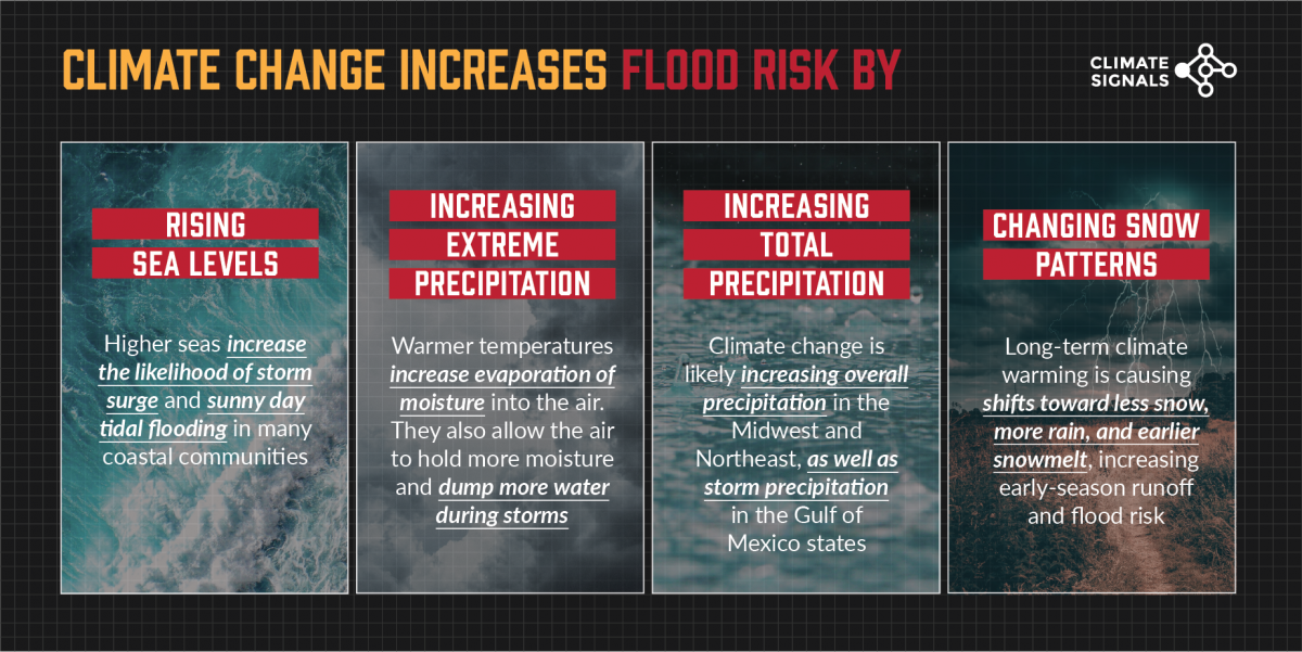
Climate change is increasing the risk of flooding in the US by rising sea levels, increasing extreme precipitation and total precipitation, intensifying storm precipitation, and increasing rates of snow and ice melt. Worsening floods due to climate change are putting a growing number of inland and coastal communities at risk.
How has climate change already worsened US flooding?
Human-caused global sea level rise is increasing the number of coastal flood days in the US.[1]
In the Mid-Atlantic, climate change contributed to widespread upward trends in stream flood magnitude and frequency since 1970.[2]
Climate change is intensifying the extreme swings between drought and flood years in California.[9]
What is flooding and why is it dangerous?
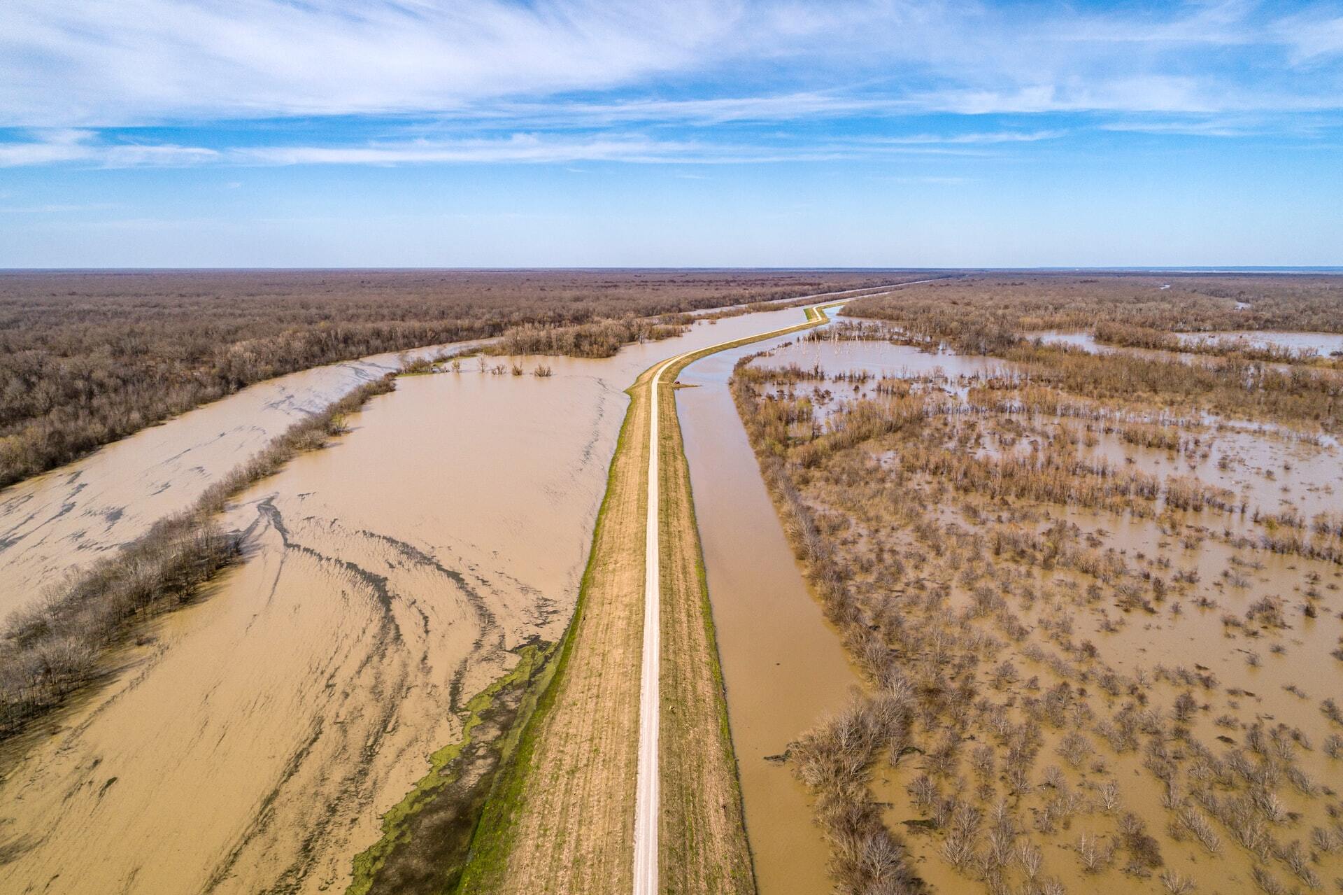
A flood is an overflowing of water onto land that is normally dry, and a flash flood is when flooding occurs less than 6 hours after an extreme rainfall event. Flooding can occur along the ocean, rivers, or lakes, and it can occur quickly or over a long period, lasting days, weeks, or longer. Flooding can be caused by heavy rainfall, rising sea levels coupled with high tides and/or storm surge, faster and earlier snowmelt, or when dams or levees break.
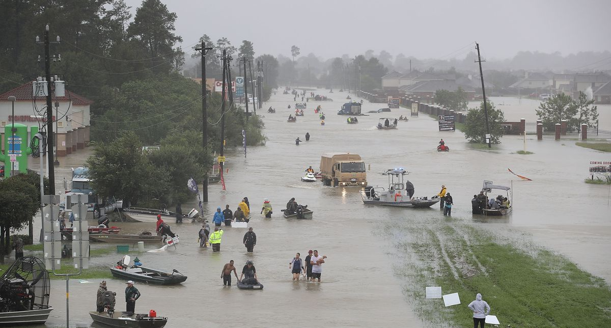
Floods are the most common and among the most deadly natural disasters in the US. Flash flooding occurs so quickly that people are often caught off-guard. People also underestimate the force and power of water: just six inches of rushing water can knock over an adult and 12 inches of rushing water can carry away most cars.
How does climate change worsen coastal flooding?
The link between climate change and coastal flooding due to sea level rise is undisputed. The combination of melting land ice and the expansion of ocean water as it warms has significantly increased the incidence of both high tide floods and the reach of storm surge - the temporary increase in sea level due to stormy conditions.
How does climate change worsen river flooding?
The influence of climate change on river flooding is more complex because of the many factors that affect riverine floods including local land use, land-cover changes, and water management. For this reason, scientists point to ways that climate change increases flood risk through changes in major flood precursors such as extreme precipitation, total precipitation, and snow/ice melt:
- Warmer temperatures increase evaporation of moisture into the air and allow the air to hold more moisture. This warm, water-laden air can then dump more precipitation, increasing runoff and flood risk.
- Observational data suggest climate change is likely increasing overall precipitation in the Midwest and Northeast, as well as storm precipitation in the Gulf of Mexico states.
- Long-term climate warming is causing shifts toward less snow, more rain, and earlier snowmelt, increasing early-season runoff and flood risk.
Event spotlight: Climate change & recent flood disasters.
The effect of climate change has been identified on many of the most infamous flooding disasters of the past few decades.
Tidal Flooding
 Human-caused sea level rise is accelerating daily tidal flooding in more than 25 Atlantic and Gulf Coast cities.[10]
- Miami (2015): Flooding in Miami on September 27 inundated about two feet of normally dry land. Since 1994, sea level rise of 4.3 inches has increased the probability of two-foot tidal floods by 500 percent.[11]

Storm Surge Flooding
Climate change driven sea level rise has increased the likelihood of storm surge flooding.
- North Carolina (2018): Approximately 1.2 million homes and 3,800 businesses were damaged by Hurricane Florence. Of the 51,000 homes that were damaged by storm surge, a report found 11,000 of them wouldn’t have been impacted if it weren’t for sea level rise.
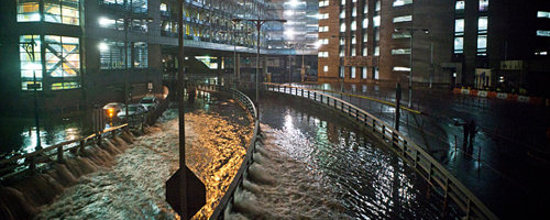
- New York & New Jersey (2012): Human-caused sea level rise extended the reach of Hurricane Sandy by 27 square miles, affecting 83,000 additional individuals living in New Jersey and New York City and adding over $2 billion in storm damage.[12]
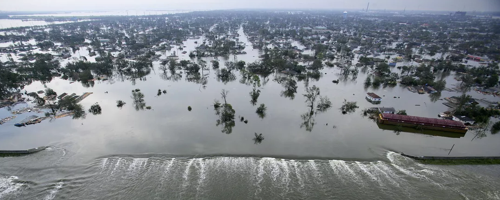
- Louisiana (2005): Hurricane Katrina would have flooded 60 percent less area of New Orleans had the storm occurred in 1900, before land subsidence and climate change increased sea levels by 30 inches.[13]
 Climate change is making tropical storms and hurricanes wetter, increasing the risk of hurricane floods.
Total Precipitation Flooding
In the Midwest and along the Mississippi River Valley, significant increases in flooding are well-documented, and the change is likely due to increases in total precipitation linked to climate change.[8]
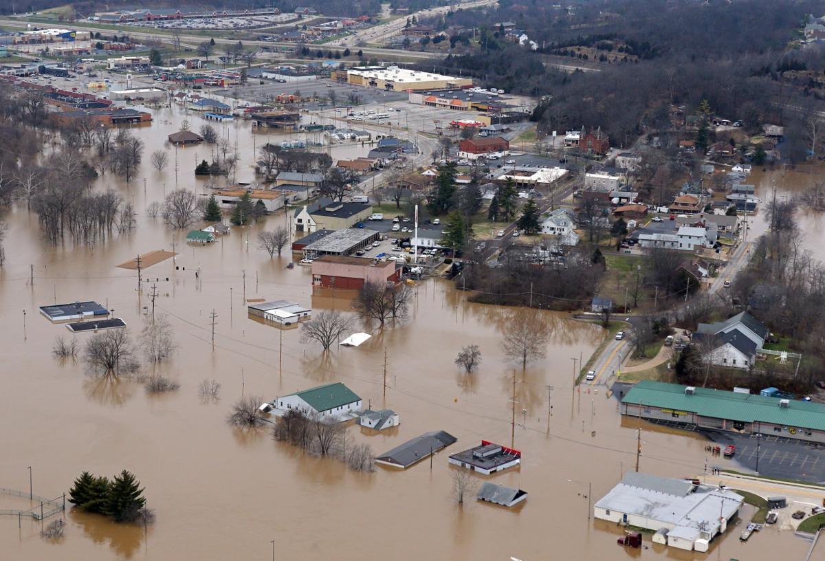
- Mississippi River Valley (2019): Midwest flooding and Mississippi River flooding was record-breaking in 2019. The Mississippi River Valley saw the most prolonged and widespread flooding in US history due to record total precipitation along the Upper Mississippi River, Arkansas River, and Missouri River, which all drain into the Lower Mississippi.

Extreme Precipitation Flash Flooding
Heavy precipitation events in most parts of the US have increased in both intensity and frequency since 1901.[10]
- Louisiana (2016): In August 2016, a historic flood resulting from 20 to 30 inches of rainfall over several days devastated a large area of southern Louisiana, causing over $10 billion in damages and 13 deaths.[10] Climate change increased the heavy rain by 20 percent.[20] Heavy precipitation events in Louisiana – such as the August 2016 event that led to flooding in southern – are occurring more frequently due to climate change.[21]

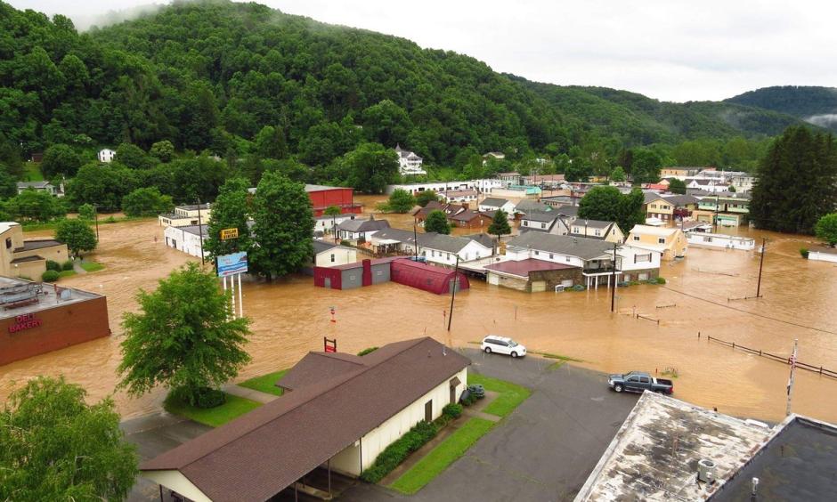
- West Virginia (2016): In June 2016, a derecho brought rains so extreme they should occur only once every 1000 years. The storm caused devastating flash flooding, record flooding on several gauged streams and small rivers, and 23 fatalities. Warming in the Gulf of Mexico due to climate change likely contributed to the storm’s intense rainfall.[22]
- Missouri (2015): At the end of December 2015, a huge storm named “Goliath” dumped 9-10 inches of rain in a belt across the central United States, centered just southwest of St. Louis, most of it in a three-day downpour. A later analysis found that human-caused warming increased the likelihood of extreme precipitation in Missouri during this event.[23]
- Colorado (2013): In 2013, persistent, heavy rains in Boulder broke several rainfall records and led to catastrophic flooding. Climate change increased the amount of moisture in the atmosphere and likely increased rainfall by 30 percent.[17][24]

Early Season Runoff Flooding
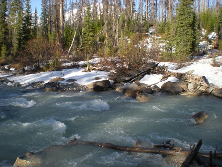
In the Western US, increasing winter temperatures are leading to decreased spring snow cover and depth, earlier snowmelt and runoff, and increased flood risk.[10] During the 2016-2017 winter, climate change decreased Sierra Nevada snowpack by nearly 20 percent, and increased early-season runoff by 30 percent.[25] That same winter, runoff in the watershed supplying the Oroville Dam prior to the Dam failure was one-third greater due to global warming.[25]
The social impacts of climate change and worsening flooding in the US
Climate change increases the risk of flood disasters that disproportionately impact low-income communities and communities of color.
There is a clear relationship between poverty and residing in flood-prone areas in cities, while findings are mixed for non-urban areas. In cities, research shows flooding is most harmful to communities of color, low-income residents, and others without the resources to handle the damage and disruption. These communities often live in the lowest-lying areas or in neighborhoods without green space to absorb water and are disproportionately impacted by disruptions to public transport infrastructure because they are more likely to hold hourly wage positions and less likely to have alternative transport options. Undocumented immigrants are particularly vulnerable, often refusing to use shelters due to fears of deportation.
Studies of the impacts of hurricane flood events demonstrate that low-income communities and communities of color are inordinately harmed by these events. When Hurricane Katrina struck New Orleans, flood impacts were disproportionately borne by the Black community. After Hurricane Harvey in Texas, Black and Latino residents and those with lower incomes reported the highest rates of property and income loss. Hurricane Sandy disproportionately impacted low-income and Black communities in New York City and New Jersey, and Hurricane Florence disproportionately impacted low-income communities and communities of color in North Carolina.
Looking specifically at sea level rise and coastal flooding, studies show that coastal communities in the South, where Black communities are a significant fraction of the population, are at the greatest risk from sea level rise. An analysis of flood insurance payments shows that flooding in the US disproportionately harms Black communities.
Research accounting for a range of socio-economic and demographic data shows a disproportionate impact on disadvantaged communities. These communities are also more likely to live in areas that will not be protected from inundation as compared to areas where less socially vulnerable groups live. For tribal communities in coastal areas, flooding due to sea-level rise is already threatening vital community infrastructure and leading to forced displacement and relocation. Indigenous coastal communities are among America's first climate refugees.
Sign Up to Receive Flooding Thought Leadership
Form temporarily disabled.


Earth Systems Signals
Heat Signals
Drought Signals
Wildfires Signals
Hurricanes Signals
Floods Signals

Rose Andreatta
Rose Andreatta is the director of the Climate Signals project and has over a decade of experience translating scientific information into usable formats for a variety of audiences. Rose earned her Master’s of Public Administration in Environmental Science and Policy at Columbia University and holds a Certificate of Achievement in Weather Forecasting from Pennsylvania State University.