Hurricane Michael October 2018
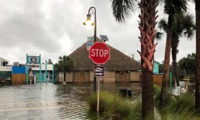
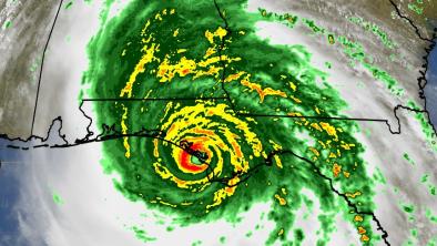
Hurricane Michael made landfall as a Category 5 hurricane near Mexico Beach, Florida on the afternoon of Wednesday, October 10th, 2018 with sustained wind speeds up to 160 mph.[1] Michael is the strongest hurricane landfall on record in the Florida Panhandle and only the second known Category 5 landfall on the northern Gulf coast.[3]
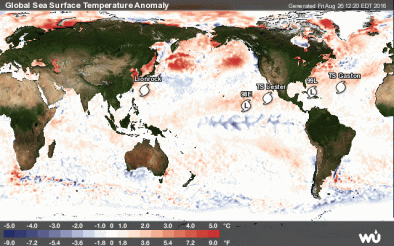
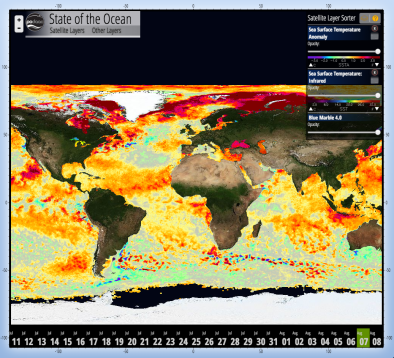
Climate change affects hurricane activity and amplifies the damages in several ways including: (1) increasing the rainfall that drops during the storm, (2) increasing sea surface temperatures which in turn raises the maximum potential energy that a storm can reach, and (3) elevating storm surge, via sea level rise, which extends the storm's reach along low-lying areas. The seas over which Michael traveled before landfall were up to 3.6°F (2°C) warmer than the historical average, a significant increase.[2]


Climate science at a glance
- Sea level rise, combined with coastal storms, has increased the risk of erosion, storm-surge damage, and flooding for coastal communities.
- Global warming is increasing water vapor in the air, which in turn is fueling extreme rainfall, increasing the threat of flooding driven by hurricanes.[1]
- Increasing sea surface temperatures are increasing the potential energy available to passing storms.[2]
- Five attribution studies found that global warming added to the deluge of rainfall dumped by Hurricane Harvey.[3][4][5][6][7]
- From 1963 to 2012, 88 percent of storm-related fatalities occurred in water-related incidents; storm surge caused 49 percent and freshwater floods due to heavy rainfall caused 27 percent.[8][9]
Climate signal #1: Extreme precipitation increase
Unusually warm seas and a warmer atmosphere are expected to help supercharge the rains delivered by Michael and amplify local flash flooding.
As the global average temperature increases, so too does the ability of the atmosphere to hold and dump more water when it rains.[1] Atmospheric water vapor has been increasing,[10][11] and the observed increases have been studied and formally attributed to global warming.[12][13][14] An increase in rainfall rates is one of the more confident predictions of the effects of climate change on tropical cyclones.[1][15]
Five attribution studies found that global warming added to the deluge of rainfall dumped by Hurricane Harvey.[3][4][5][6][7] One estimated that climate change increased Harvey's rainfall by up to 38%.[5]
Observations consistent with climate signal #1
- The seas over which Michael traveled before landfall were up to 3.6°F (2°C) warmer than the historical average, a significant increase.[16]
- Some of the top rainfall totals from the storm were as follows: 5.26 inches at Sumatra, FL; 5.54 inches in Ozark, AL; 6.48 inches near Powder Springs, GA; 6.01 inches near Hartsville, SC; 9.62 inches near Black Mountain and 6.75 inches near Boone, NC; and 5.75 inches near White Gate, VA.[17]
Climate signal #2: Storm surge increase
The most important impact of tropical cyclones in coastal regions is storm surge, which accounted for 49 percent of storm-related fatalities between 1963 and 2012.[8][9][15] Increases in storm surge related to climate change can be due to rising seas, increasing size, and increasing storm wind speeds.[15][18]
Climate change has already contributed about 8 inches (0.19 meters) to global sea level rise,[12] and this has dramatically amplified the impact of cyclones by increasing baseline elevations for waves and storm surge.[12][19][20][21] A small vertical increase in sea level can translate into a very large increase in horizontal reach by storm surge depending upon local topography. For example, sea level rise extended the reach of Hurricane Sandy by 27 square miles, affecting 83,000 additional individuals living in New Jersey and New York City[19] and adding over $2 billion in storm damage.[21]
Sea level is rising at a rate of about 0.75 feet per 100 years at two stations
Observations consistent with climate signal #2
- On the afternoon of October 10, Apalachicola saw storm surge of 7.72 feet.[17] The city's previous record was 6.43 feet.[17] Sea level there is rising at a rate of 0.73 feet per 100 years.[22]
- The National Hurricane Center's Storm Surge Unit estimates that an area of the Florida coast extending from Mexico Beach through Apalachee Bay saw peak storm surge inundation values of 9-14 feet.[17] Sea level near Mexico Beach is rising at a rate of 0.75 feet per 100 years.[23]
Climate signal #3: Intense Atlantic hurricane frequency increase
Tropical cyclones are fueled by available heat. Warming seas have increased the potential energy available to passing storms, effectively increasing the power ceiling or speed limit for these cyclones.[15][24] In parallel, there has been a global increase in the observed intensity of the strongest storms over recent decades.[25][26]
The fingerprint of climate change has been documented in tropical cyclone activity. And for the Atlantic in particular, the U.S. National Climate Assessment reports that in the Atlantic human factors have "contributed to the observed increase in hurricane activity since the 1970s.”[27]
Observations consistent with climate signal #3
- Michael was fueled by unusually warm seas (up to 3.6°F/2°C warmer than the historical average)[16] that heated past the 83.3°F (28.5˚C) threshold for powering a major hurricane. Warming seas are a signal of climate change.
- Storm winds up to 160 mph were recorded at the time of landfall — making it a Category 5 hurricane at landfall.[28]
- Michael is the strongest hurricane landfall on record in the Florida Panhandle and only the second known Category 5 landfall on the northern Gulf coast.[28]
Related Content

