Catastrophic Rains, Floods, Mudslides Possible as Lane Nears Hawaii

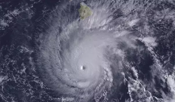
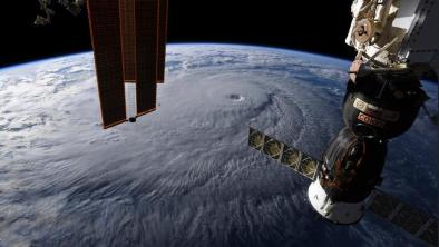
Still a powerful Category 4 storm, Hurricane Lane began its gradual turn northwest toward the Hawaiian Islands on Wednesday. On a broad looping path predicted from Thursday to Saturday, the hurricane could make landfall on any or none of the islands. Yet even a track that keeps Lane offshore will have the potential to bring damaging tropical-storm-force winds, torrential rains, and major flooding to large parts of Hawaii.
...
As it pushed westward well southeast of Hawaii, Lane underwent a jaw-dropping round of sustained intensification on Monday that pushed the storm into Category 5 territory by late Monday night, with top sustained winds peaking at 160 mph. The storm benefited from warm sea surface temperatures of 27-28°C (81-82°F), light wind shear (around 10 knots), a moist mid-level atmosphere, and upper-level outflow that kept the storm’s heat-engine chimney working at fearsome strength. Lane’s central pressure dropped to as low as 922 mb. We’re fortunate that NOAA and Air Force Hurricane Hunters have been able to carry out frequnt missions into Lane, in part because the Atlantic tropics have been so quiet.
...
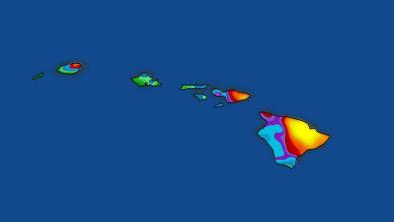
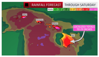
Lane’s powerful and well-established circulation will send huge amounts of tropical moisture flowing against the islands’ rugged terrain. This will lead to periods of torrential rain that could extend over several days in the most favored spots, especially across north- and east-facing slopes. Totals of 10” – 20” can be expected across large parts of Hawaii, and I would not be at all surprised to see localized amounts well above 30”, especially along east-facing slopes of the Big Island and Maui. Massive flows from these rains could lead to floods, landslides, and road washouts.
...
The latest Hurricane Local Statement from the NOAA/NWS Central Pacific Hurricane Center (CPHC) said to expect locally hazardous storm surge impacts across south and west facing coasts of the islands:
- Localized inundation with storm surge flooding mainly along immediate shorelines and in low-lying spots, or in areas farther inland near where higher surge waters move ashore.
- Sections of near-shore roads and parking lots become overspread with surge water. Driving conditions dangerous in places where surge water covers the road.
- Moderate beach erosion. Heavy surf also breaching dunes, mainly in usually vulnerable locations. Strong rip currents.
- Minor to locally moderate damage to marinas, docks, boardwalks, and piers. A few small craft broken away from moorings.
Elsewhere across the Hawaiian Islands, little to no impact from storm surge is anticipated.
A bigger threat than the storm surge is the waves Hurricane Lane will generate. The latest marine forecasts for the leeward waters of the Big Island and Maui call for waves of up to 25 feet at the peak of the storm.
Related Content


