Atlantic Tropical Storm Tracking
Unisys

The UNISYS Atlantic tropical storm tracker provides access to a wealth of hurricane information—in the Atlantic, East Pacific, West Pacific, South Pacific, South Indian, and North Indian ocean basins—including charts on the track of storms plus a text based table of tracking information.
The table includes position in latitude and longitude, maximum sustained winds in knots, and central pressure in millibars.
Related Content
Headline
Nov 28, 2016 | Category 6
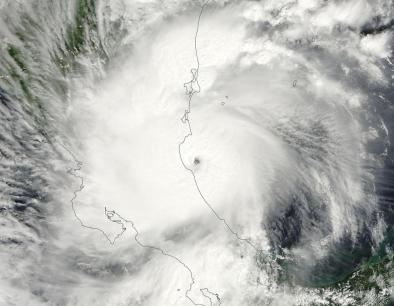
Otto Shifts from Atlantic to Pacific after Historic Landfall in Central America
Headline

Nov 28, 2016 | The Weather Channel
Hurricane Otto Death Toll Rises to Double Digits
Headline

Nov 28, 2016 | Los Angeles Times via Associated Press
Hurricane Otto bears down on Central America unusually late in season
Headline
Nov 22, 2016 | The Weather Channel
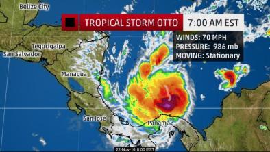
Tropical Storm Otto Nears Hurricane Strength; Forecast to Make Very Rare Thanksgiving Hurricane Central America Landfall