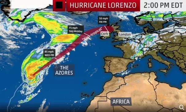
Hurricane Lorenzo to Lash the Azores With Strong Winds, 50-Foot Waves; Post-Tropical Low to Move Near Ireland, U.K.

Significant wave heights are forecast to be up to 45 to 50 feet as Lorenzo makes its closest pass to the Azores.
Lorenzo's large circulation is also generating swells over much of the North Atlantic Ocean that will lead to dangerous surf at the beaches of the East Coast of the United States, many Caribbean islands, the Bahamas, Bermuda, western Europe and Atlantic Canada over the next few days.
...
According to NOAA's historical database, only seven Category 2 or stronger hurricanes have tracked within 200 nautical miles of the Azores in records dating to the mid-19th century.
...
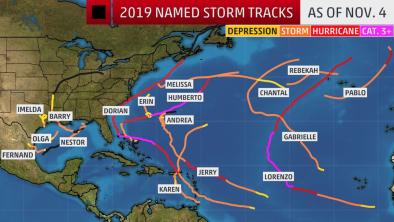
Lorenzo rapidly deepened Saturday from Category 3 status with estimated maximum sustained winds of 115 mph at 11 a.m. EDT to Category 5 status with winds of 160 mph just 12 hours later.
This is by far the farthest east in the Atlantic Ocean any of the previous 35 Category 5 hurricanes have occurred in records dating to the 1920s.
...
Lorenzo also had the lowest pressure for a hurricane east of 50 degrees west longitude on record Saturday evening and had been a major hurricane for the longest period of time east of 45 degrees west longitude on record, according to Colorado State University tropical scientist Dr. Phil Klotzbach.
Lorenzo was the second Category 5 hurricane of the 2019 Atlantic hurricane season and the sixth such top-end hurricane to form in the Atlantic Basin in a little less than three years, following Matthew, Irma, Maria, Michael and Dorian.
Related Content


