Growing Risk of Hurricane Impacting Gulf Coast of Florida This Week

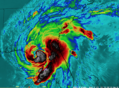
The storm north of Cuba may yet strengthen into a hurricane in the Gulf of Mexico with possible landfall later this week, anywhere from Tampa to Mobile. The normally-reliable ECMWF model now spins up a hurricane in the Gulf, so my confidence level is going up.
As of last night NOAA NHC predicted a 40% chance of tropical storm strength within 48 hours; a 50% risk of Tropical Storm Hermine within 5 days...
A few model runs on Saturday bring "Hermine" into the Gulf Coast of Florida near Tampa on Wednesday; a solution that is becoming increasingly believable. That said, confidence levels remain low...
Saturday's 12z ECMWF model showed a rapidly-strengthening "Hermine"pushing into Mobile or Pensacola late Friday of this week. Timing, track and intensity is still very much up in the air; people living along the Gulf Coast from Naples to New Orleans need to pay close attention
Related Content


