Recent increases in tropical cyclone precipitation extremes over the US east coast
Study significance & key findings
-
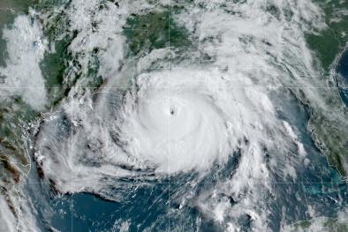
Sluggish hurricanes are dumping more rain over the coastal Southeast than in centuries past thanks to climate change.
-
Over 300 years of tree ring data show how rainfall from hurricanes has changed in the Carolinas.
-
Extremes in tropical cyclone precipitation have increased between 64 to 128 millimeters (2.52 to 5.04 inches) compared with the early 1700s, mostly in the last six decades
-
This study documents increases in extremes of summed tropical cyclone precipitation, which provides another line of evidence that the speed of movement of tropical cyclones is slowing.
Author quotes
"The key takeaway is that this increase is only seen in the wettest storms. So take the recent Hurricanes Nicholas or Ida, for example, which produced maximum rainfall of about 14 inches and 11 inches. If these storms occurred in the early 1700s, they would have produced 2.5 to 5 inches less rainfall."
"Having an additional 2.5 to 5 inches for today's wettest storms make them much more hazardous, as that amount of rainfall by itself can cause localized flooding. Adding those totals on top of 9 to 10 inches of rain over a widespread area can lead to large flooding, especially in coastal cities that have a lot of impervious surfaces, so there is nowhere for the water to go."
Justin T. Maxwell, lead-author and associate professor in the Department of Geography in the IU Bloomington College of Arts and Sciences
“What used to be a really big year 300 years ago would only be kind of a moderate year today,” he says. “So we’re getting much higher numbers, particularly since the 1990s, of the overall maximum amount of rainfall you can get from hurricanes than we have in the past.”
"The wettest years are getting even wetter. We’re truly in uncharted territory with this amount of rainfall."
Abstract
The impacts of inland flooding caused by tropical cyclones (TCs), including loss of life, infrastructure disruption, and alteration of natural landscapes, have increased over recent decades. While these impacts are well documented, changes in TC precipitation extremes—the proximate cause of such inland flooding—have been more difficult to detect. Here, we present a latewood tree-ring–based record of seasonal (June 1 through October 15) TC precipitation sums (ΣTCP) from the region in North America that receives the most ΣTCP: coastal North and South Carolina. Our 319-y-long ΣTCP reconstruction reveals that ΣTCP extremes (≥0.95 quantile) have increased by 2 to 4 mm/decade since 1700 CE, with most of the increase occurring in the last 60 y. Consistent with the hypothesis that TCs are moving slower under anthropogenic climate change, we show that seasonal ΣTCP along the US East Coast are positively related to seasonal average TC duration and TC translation speed.


