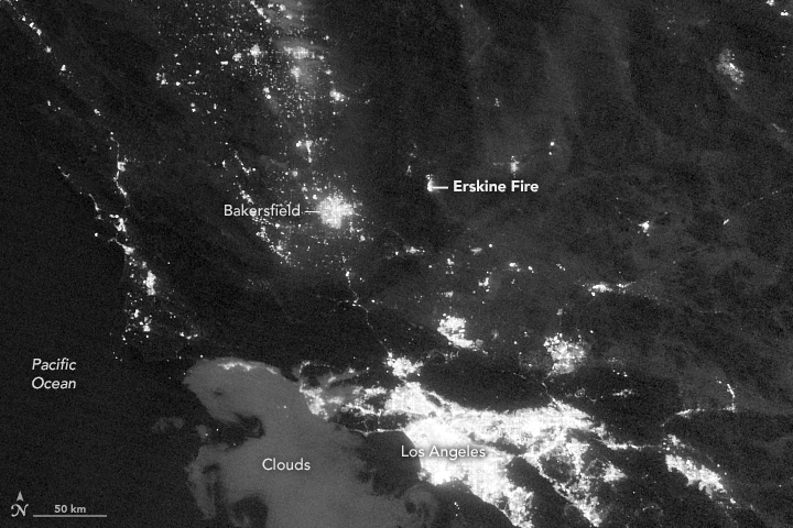
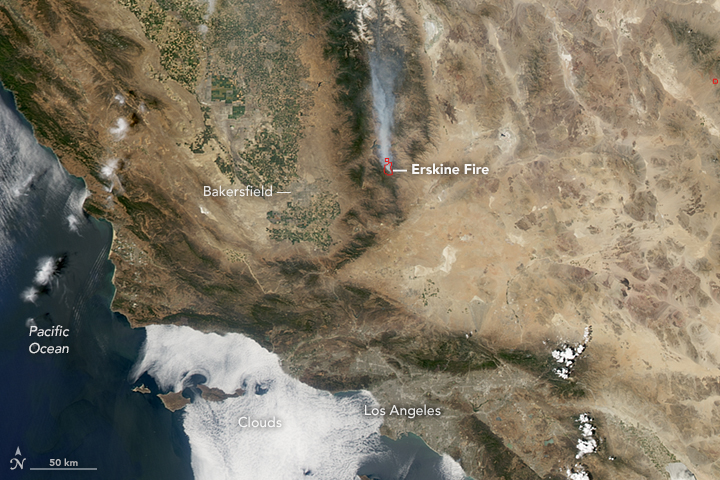
Photos: Erskine Fire Satellite Images
by NASA Earth Observatory
The top image shows the region at 3:34 a.m. Pacific Time on June 26, 2016. It was acquired with the day-night band (DNB) of the Visible Infrared Imaging Radiometer Suite (VIIRS) on the Suomi NPP satellite. The DNB can detect relatively dim signals such as city lights and reflected moonlight. In this case it also shows the glow of wildfire.
The second image shows the fire later that same day. This natural-color image was acquired with the Moderate Resolution Imaging Spectroradiometer (MODIS) instrument on NASA’s Aqua satellite. Red outlines indicate hot spots where MODIS detected warm surface temperatures associated with fires. Winds carried smoke from the fire northward.


