Searing, prolonged heatwave developing across much of California & Desert Southwest
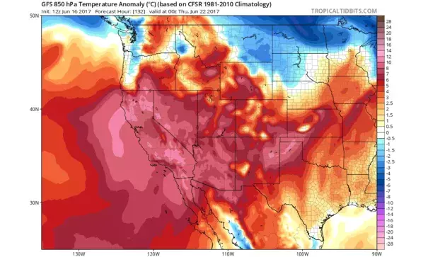
Prolonged, dangerous heatwave imminent for areas away from coast
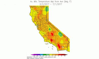
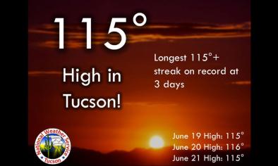
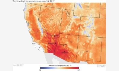
After a relatively mild May and early June period across most of California, a rather remarkable heatwave is already underway and will likely persist for many days. Today will be the first of potentially 7-10 very hot days across inland portions of California and interior portions of the American Southwest, and numerous high temperature records are likely to fall in the coming days. The upcoming heat will be of a dangerous intensity and duration in a significant number of highly populated regions, including the Phoenix, Tuscon, Las Vegas, Bakersfield, Fresno, and Sacramento metropolitan areas. Cities closer to the Pacific coast will still see hot to very hot temperatures over the next week, but not to quite as exceptional a degree as these inland areas.
Dynamics of a heatwave with some unusual characteristics
The present heatwave strongly resembles a similar event which occurred just last year (in June 2016), which brought record temperatures to inland desert portions of the Southwest. The event over the next 7-10 days, however, has the potentially to slightly more intense and significantly more prolonged–meaning that overall impacts could be considerably greater...
Though it’s often California’s good fortune to experience “dry heat”–during which low surface dewpoints actually decrease the “apparent temperature” and take the edge off otherwise searing temperatures–that won’t necessarily be the case during the present heatwave. An unusually moist airmass is currently in place over much of California, which can be linked to the passage of an unusually strong atmospheric river over the Pacific Northwest yesterday (which brought heavy June rain to Washington but just clouds to Northern California). Linger moisture will become trapped within the stagnant airmass under the building ridge–which ultimately means that the extreme temperatures associated with the upcoming heatwave will coincide with a rather moist airmass and unusually high surface dewpoints.
This added moisture has several implications. First, it will make the intense heat feel even more oppressive (i.e. “muggy”), as apparent temperatures will not fall below the actual temperature as they often do during California heatwaves. Second, higher dewpoints will greatly inhibit overnight cooling across inland areas. In fact, portions of the Central Valley could see overnight lows staying as high as 70-80 degrees. Lack of overnight cooling is one of the strongest predictors of heat-related illness during prolonged heatwaves, so this presents significant concerns. Finally, the relatively “juicy” airmass by California standards will allow afternoon thunderstorms to develop over the Sierra Nevada on most afternoons during the heatwave. While not currently depicted in model forecasts, previous experience with events like these suggests that there will be at least a small chance of some convective build-ups and perhaps some isolated thunderstorms outside of the Sierra Nevada. These would be most likely over the San Joaquin Valley, where the confluence of extremely hot temperatures and outflow boundaries propagating away from Sierra Nevada storms could act as a localized trigger. The chance of this happening is low, but it’s worth mentioning as an indicator that this heatwave is a departure from the norm in California.
Related Content
