All Eyes on East Coast as Big Snowmaker Looms for Tuesday

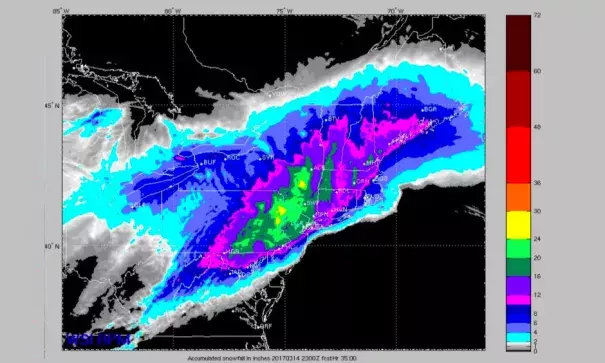
There’s no doubt that a big storm is in the cards. Upper-level energy from two sources—a large trough swinging across the Midwest and a upper-level wave at the base of this trough over the Southern Plains—will be joining forces along the East Coast by Tuesday. The interplay between these two factors is just one of the elements of uncertainty on the table.
What’s clear is that a surface low off the central Gulf Coast on Monday morning will begin to strengthen near the Outer Banks Monday night, then rapidly intensify as it moves northeast along and/or just off the East Coast through the day on Tuesday. As shown in Figure 1 below, the 12Z Monday run of the GFS model deepens the low 23 millibars in 24 hours, from 2:00 am EDT Tuesday to 2:00 am Wednesday, as it moves from near Cape Hatteras, NC (1000 mb), to the central coast of Maine (977 mb). This would bring the low very close to the official definition of a meteorological “bomb”—a midlatitude low that deepens at least 24 millibars in 24 hours.
![]()
The surface low associated with Winter Storm Stella will deepen very rapidly as it progresses from offshore Delaware to Maine from 2:00 am EDT Tuesday, March 16, to 2:00 am EDT Wednesday. Colors depict the altitude, in tens of meters, of the 500-millibar surface, corresponding to the upper-level low digging sharply into the East Coast and supporting the strengthening of the surface low. Image: tropicaltidbits.com
...
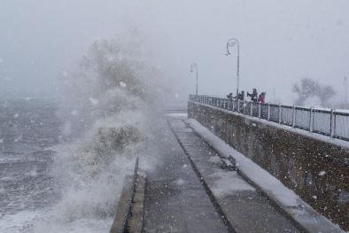
The exceptionally strong winds of Stella will drive a peak storm surge of 1 - 3 feet on Tuesday along much of the coast of Delaware, New Jersey, New York, Connecticut, and Massachusetts, including Cape Cod and the islands. The main concern for coastal flooding will come Tuesday during the late morning/early afternoon high tide cycle, when the strong winds of the storm will coincide with high waters from a higher-than-usual high tide, due to the the full moon that occurred on Sunday. The highest storm tides are expected in western Long Island Sound, where the peak storm surge is expected about two hours after high tide early Tuesday afternoon. Wave heights on the ocean waters off the coast are forecast to range from 12 to 18 feet, with breaking waves of 6 to 10 feet at the shore, especially along the Atlantic-facing Delaware and Jersey beaches.
The waves and storm surge will cause significant coastal erosion. However, only minor to moderate coastal flooding is expected, due to the relatively rapid motion of the storm across the area. Slow-moving nor’easters are a much bigger coastal flooding threats, since the wind has more time to pile large amounts of water up against the coast. According to Monday morning run of the experimental NOAA Extratropical Storm Surge Model, these are the peak storm surge (height of the water above normal) and storm tide (height of the water above the high tide mark) expected on Tuesday along the coast:
- Boston, MA: 2.6’ storm surge, 0.7’ storm tide (peak storm surge occurs at low tide, so a relatively low peak storm tide occurs)
- Bridgeport, CT: 3.0’ storm surge, 1.5’ storm tide
- King’s Point, NY (east side of NYC): 3.5’ storm surge, 2.5’ storm tide
- The Battery, NY: 2.3’ storm surge, 1.4’ storm tide
- Sandy Hook, NJ: 2.6’ storm surge, 1.6’ storm tide
- Atlantic City, NJ: 2.1’ storm surge, 1.6’ storm tide
- Lewes, DE: 2.1’ storm surge, 1.3’ storm tide
Related Content


