Could the Imminent U.S. Heat Wave Trigger a Flash Drought?

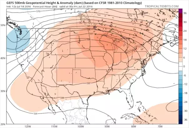
A massive upper-level high will envelop most of the contiguous U.S. in the last half of July, setting up what could be a prolonged bout of extreme heat for millions of Americans. If the scorching weather persists into August, the odds of a “flash drought” in the nation’s heartland will rise sharply (along with the odds that the U.S. will notch its hottest summer on record, in line with what’s very likely to be Earth’s warmest year on record). Even though it appears that heat and humidity will combine to put residents, pets, and livestock through the wringer, it’s quite possible that the croplands of the Midwest and Plains will fare better than one might expect, thanks to a fortunate confluence of factors.
...
The atmospheric variables predicted to take shape later this week are similar to those observed during some of the nation’s most notorious heat waves of recent decades...[T]he closest analog for conditions predicted for the Midwest (taking into account temperatures, moisture, and other factors at various layers) is July 13, 1995--the second day of a catastrophic five-day heat wave that took more than 700 lives in the Chicago area. The top analogs also include July 4, 2012, and August 7, 1980, two peak days from the devastating central U.S. drought years of 2012 and 1980
Related Content


