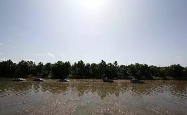
Texas Was In a Horrible Drought Last Year. Now It’s Flooded. What Gives?

A torrential, hurricane-like series of rainstorms hit Texas over the weekend, stranding hundreds, and producing a flood that Texas Gov. Greg Abbott said hit with “tsunami-type power"...
The National Weather Service in Houston called the storm a ‘flash flood emergency’—a rare warning...
During the rain’s peak Monday night, Houston received nearly an inch of rainfall in just five minutes, and racked up nearly a foot in less than a day. The flooding in Houston was comparable to a landfalling tropical storm or hurricane. Water levels along Buffalo Bayou, which runs through downtown, eclipsed the level seen during Hurricane Ike in 2008, and was just shy of flooding during Tropical Storm Allison—the worst flood in Houston history—which dawdled over the city for six days in 2001 and inundated 70,000 houses.
Over the longer term, this kind of weather isn’t totally unexpected—extreme swings in precipitation are becoming the new normal. This month’s heavy rains are directly linked to a building El Niño in the tropical Pacific Ocean, which is forecast to strengthen throughout the summer, meaning heavy rains could return to the southern plains at regular intervals. A steadily escalating whipsaw between drought and flood is one of the most confident predictions of an atmosphere with enhanced evaporation rates—meaning, global warming. Since 1958, there’s been a 16 percent increase in the amount of rain falling in the heaviest rainstorms on the Plains, even as long-term projections point toward an increased risk of megadrought. Both of these can happen at the same time. Texas’s quick transition from drought hellscape to underwater theme park was egged on by both El Niño and climate change


