Strange times in the tropics: Hurricane Pali in the Central Pacific
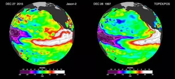
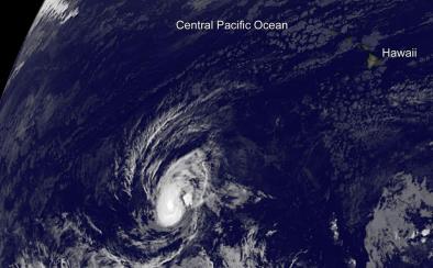
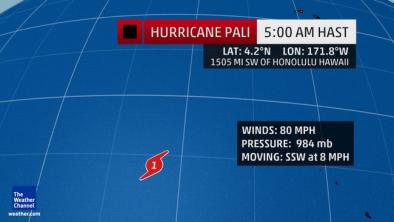
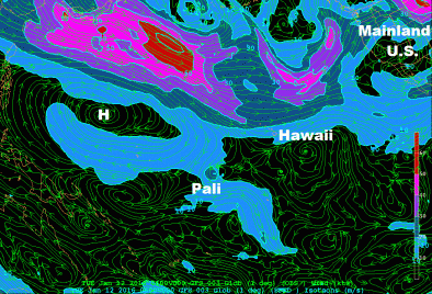
It’s not entirely out of the question that a tropical cyclone will be churning over or just west of the Central Pacific the field campaign kicks off next week. Late Monday night, Hurricane Pali became the earliest hurricane on record for both the Central and Northeast Pacific (the region between the International Date Line and the Americas), beating 1992’s Ekeka, which became a hurricane on January 30. Still packing winds of 85 mph early Tuesday morning, Pali was located unusually close to the equator--at 7.5°N, 171.6°W, or about 1300 miles southwest of Honolulu--and was moving south-southeast at about 7 mph. Pali should continue drifting equatorward over the next several days, gradually bending toward the west and potentially back toward the west-northwest if it hangs on. Sea-surface temperatures are more than warm enough to support Pali along its projected track, at 28-29°C (82-84°F). However, moderate wind shear (10 - 20 knots) could keep Pali from strengthening, and there are few historical precedents for tropical cyclones at such low latitudes
Related Content
