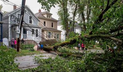
‘Life-threatening’ storm surge, torrential rains and hurricane force winds pound the Carolinas as Hurricane Dorian grinds north
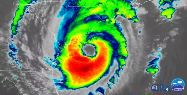
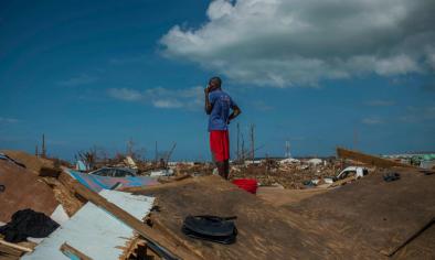
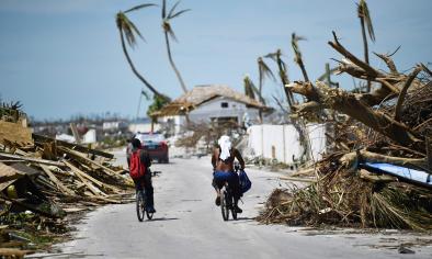
Powerful Hurricane Dorian is unleashing its full array of hazards on the Carolinas just days after causing a humanitarian crisis in the northwestern Bahamas and then zagging around the Florida Peninsula.
The high-end Category 2 storm has already flooded parts of downtown Charleston, S.C., with a combination of storm surge and rainfall runoff, prompting a flash-flood warning through mid-morning there, in addition to a storm-surge warning.
The storm’s winds have decreased slightly since Thursday morning, when the storm was rated a Category 3 “major” hurricane. However, in terms of impacts, there’s little difference between a low-end Category 3 storm and a high-end Category 2. Notably, the storm’s wind field has expanded over time, with tropical-storm and hurricane-force winds covering more territory.
...
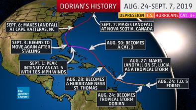
As of 11 a.m. ET, Hurricane Dorian was located 50 miles southeast of Charleston, S.C., and about 140 miles south-southwest of Wilmington, N.C. The storm was moving north-northeast at 8 mph.
Hurricane Dorian had maximum sustained winds of 110 mph, with higher gusts, making it a Category 2 storm. It is forecast to weaken some on Thursday as it interacts with land and is exposed to wind shear, or winds moving with different speeds or direction with height.
Related Content