At Least 13 Killed by Flooding, Mudslides in Fire-Scarred Southern California

Fire leads to flood all too often, but seldom with such tragic results as in Southern California early Tuesday. Flash floods and mudslides took at least 13 lives in Montecito, an unincorporated coastal area of about 9000 residents just east of Santa Barbara. Heavy overnight rains cascaded onto hillsides denuded by catastrophic fire in December, leading to the floods and mudslides.
At least 25 other injuries were reported in Montecito. Dozens of residents were rescued, according to the Los Angeles Times. The toll may rise as searchers make their way into areas that were impossible to access late Tuesday. A smaller but still-damaging mudslide was reported in a Burbank neighborhood affected by the La Tuna Canyon Fire last September.
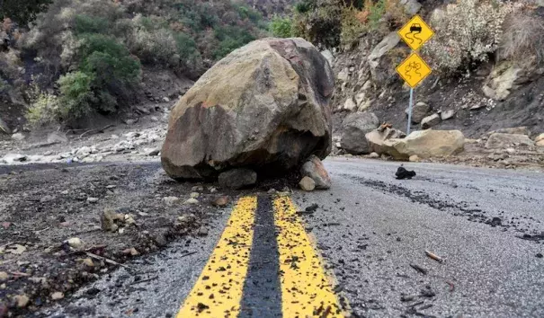
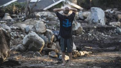
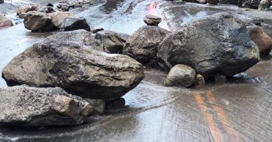
The damage in Montecito “looked like a World War I battlefield,” Santa Barbara sheriff Bill Brown told CNN. “"It was literally a carpet of mud and debris everywhere, with huge boulders, rocks, downed trees, power lines, wrecked cars…”
...
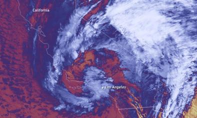
The storm that triggered Tuesday’s disaster was certainly a wet one for California, albeit not a record-breaker. San Francisco International Airport picked up 3.12” on Monday, which made it the fourth wettest calendar day in records that go back to 1945. The 3.15” in downtown San Francisco was the sixteenth-highest calendar day total since records began there in October 1849. These calendar-day totals happened to benefit from the storm’s Bay Area timing, as most of the rain fell snugly in the midnight-to-midnight window, according to WU weather historian Christopher Burt. “By no means did this rain event rank among what the 24-hour totals may have been during previous events,” said Burt.
For Southern California, rainfall amounts came in slightly under the forecast amounts issued late Sunday. The two-day totals of 2.52” in Santa Barbara and 1.49” in downtown Los Angeles were substantially less than two-day totals of 4.31” and 2.10” recorded just last year, in mid-February 2017.
However, the rainfall rates were very heavy—a classic risk factor for flash flooding—in and near the Thomas Fire burn scar, boosted by thunderstorms embedded within the rain areas. A total of 0.54” was reported in just five minutes at Montecito and 0.86” in 15 minutes at Carpenteria. "Any storm that has intensities greater than about 10 millimeters/hour (0.4"/hour) poses the risk of producing debris flows” when occuring over fire-scarred areas, says the U.S. Geological Survey.
Above all, the massive burn scar produced by the Thomas Fire, the largest wildland fire in modern California history, left the region exceptionally vulnerable to even a garden-variety winter rain.
...
Even after the Monday/Tuesday deluge, California has yet to catch up to the precipitation amounts received by early January in an average year. The March-to-December period brought just 0.69” of rain to Los Angeles. That smashed the previous Mar-to-Dec. record of 1.24”, as reported by California Weather Blog. For the state’s entire South Coast Drainage climate region, the Oct-to-Dec. period was tied for the second driest in records going back to 1895, topped only by 1929 and matched only by 1903.
Related Content


