Hurricane Harvey Strengthens to 110 mph Winds; Catastrophic Flooding Likely in Texas
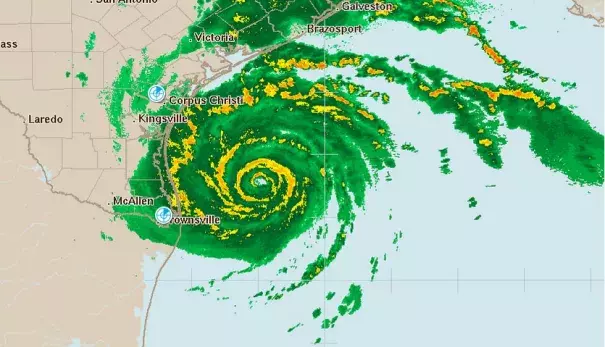
Hurricane Harvey is poised to deliver a catastrophic flooding blow to Texas after putting on an impressive round of rapid deepening Friday morning that brought the storm to the verge of Category 3 strength. Harvey passed over a warm ocean eddy with high heat content for over 6 hours Friday morning, and the extra energy the eddy provided allowed Harvey’s central pressure to fall a spectacular 15 mb in just two hours, from 967 mb at 4 am CDT to 952 mb at 6 am CDT. It takes several hours for a hurricane’s winds to respond to a rapid pressure fall, so we can expect that Harvey will be a Category 3 hurricane with 120 mph winds by Friday evening. An Air Force hurricane hunter aircraft in the storm this morning was continuing to see falling pressures, with the 8 am CDT eye penetration recording a 949 mb pressure. The aircraft also observed evidence that an eyewall replacement cycle was beginning. In this situation, the inner eyewall would collapse and be replaced by a new eyewall with a larger diameter, which would likely slow down or end Harvey’s intensification phase.
Related Content