How does latest Ellicott City storm stack up with 2016? Meteorologists weigh in
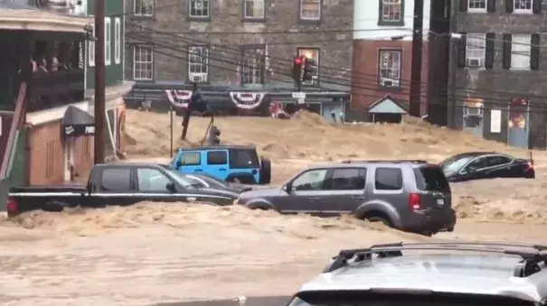
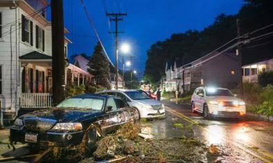
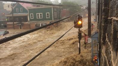
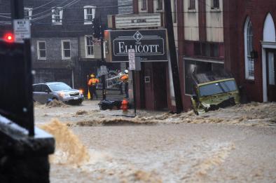
The storm that hit historic Ellicott City and nearby areas Sunday is likely worse than the storm that caused flooding in 2016, according to meteorologists.
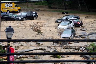
By 7 p.m. Sunday, rainfall totals already appeared to be higher; 7.48 inches had fallen in Ellicott City, according to National Weather Service meteorologist Brian LaSorsa, and 9.71 inches of rain had fallen in Catonsville. A flash flood warning remained in effect for Columbia, Severn and Jessup until 12:45 a.m. Monday morning.
In the devastating storm of July 2016, Ellicott City was hit by 6.5 inches of rain, while Catonsville got 4.2 inches.
“It’s a rare event for it to rain this much," LaSorsa said.
...
“It’s not totally unheard of” to have two big storms within a two-year span as Ellicott City received, said LaSorsa, but it is unusual. However, he noted that storms are more frequent in the summertime, due to a combination of moisture in the air and hotter temperatures near the earth’s surface
Related Content