Historic Flood Event in Louisiana From 20-30 Inches of Rain

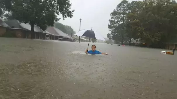
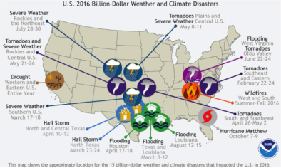
A historic flooding event continues over southern Louisiana, where widespread rainfall amounts in excess of twenty inches since Friday have brought all ten river gauges on the Amite, Tickfaw, and Comite Rivers to record flood crests, flooded thousands of homes, and caused over 1,000 water rescues. The most extreme floods have occurred on the Amite River, which flows along the east side of the Baton Rouge metropolitan area. Flood waters stranded hundreds of cars on Interstate 12 just east of Baton Rouge for more than 24 hours, Saturday through Sunday. About 25 miles east-southeast of Baton Rouge, the flood crest on the Amite River appears likely to overtop the levee system built at Port Vincent after the destructive floods of April 1983 (at the tail end of the 1982-83 “super” El Niño). The flood control system was designed to handle a recurrence of the 14.6-foot crest observed in that record event. However, the Amite at Port Vincent had already reached 14.91 feet as of 9:15 am CDT Sunday, and it is projected to hit a crest of 16.5 feet early Monday, remaining above the previous record until Tuesday. Major flooding can be expected to the south of Port Vincent in southern parts of Ascension Parish, where voluntary evacuations are already in effect. “If you can get out, get out now,” said parish president Kenny Matassa on Sunday morning.
...
The storm system responsible for the record rains formed a distinct surface low just inland along the Alabama coast on August 11, with a central pressure of 1013 mb. By August 13, the low had drifted over northwest Louisiana, and intensified to a central pressure of 1007 mb. Like a tropical depression, the low had a warm core, and the counter-clockwise flow of air around the storm brought huge amounts of tropical moisture from the near record-warm waters of the Gulf of Mexico and northwest Atlantic northwards over land. The amount of moisture in the atmosphere over the Gulf Coast region over the past week has been nothing short of phenomenal. Over multiple days, soundings of the atmosphere collected by weather balloon from locations such as New Orleans have measured record or near-record amounts of precipitable water (the amount of moisture in the atmosphere over a given point), often in the 2.5” to 2.75” range; sounding data extends back to 1948 in most cases. Sunday morning’s precipitable water of 2.61” in Lake Charles, LA, was among the top-ten values on record for that station
Related Content


